Ground displacement monitoring
See when the ground starts to move
Unattended RTK GNSS monitoring for landslides, slopes, subsidence and infrastructure. Each rover reports its movement in millimetres every 6 hours — installed once and left in place.
Measure displacement without building a survey campaign around every reading
Traditional campaigns give precise snapshots, but every reading costs people, equipment and site access. Survey-grade receivers are built for a working day in an operator’s hands — leaving one on a slope permanently means adding an external power system, an enclosure and a mount.
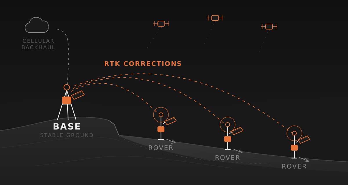
Grillo Slide starts from the opposite premise. Integrated solar power and onboard battery management are sized for intermittent measurement rather than continuous survey, so the network is installed once and left: each device wakes on schedule, fixes its position against the base, reports over a shared cellular link, and returns to sleep.
Operational teams can work with compact displacement records. Researchers can additionally request raw base and rover GNSS observations for validation, independent post-processing, and method development.
Where Grillo Slide fits
Landslides & natural slopes
Monitor known movement zones and changing slope geometry with persistent reference points.
Mines & tailings facilities
Add affordable measurement points across operational slopes, waste areas, and containment structures.
Subsidence
Track gradual vertical and horizontal movement related to extraction, groundwater, construction, or natural processes.
Roads & rail corridors
Observe unstable cuttings, embankments, and ground movement affecting linear infrastructure.
Dams & engineered structures
Measure external displacement around earthworks and critical fixed assets.
Volcanic deformation
Create dense research networks for repeated position measurements around changing volcanic terrain.
Pilot programme
Developed with research workflows in mind
Oregon State University is running a pilot programme with Grillo Slide for unattended landslide monitoring. Support for both compact monitoring records and raw GNSS observations makes the system useful for applied monitoring and for deeper scientific analysis.
Plan the right network for your site
Tell us about the terrain, expected movement, site access, cellular coverage, and how often you need a measurement.